3D Visualization
image from University of Nebraska-Lincoln Campus Mapsimage from University of Nebraska-Lincoln Campus Mapsimage from University of Nebraska-Lincoln Campus Mapsimage from University of Nebraska-Lincoln Campus Mapsimage from University of Nebraska-Lincoln Campus Maps

University of Nebraska-Lincoln Campus Maps

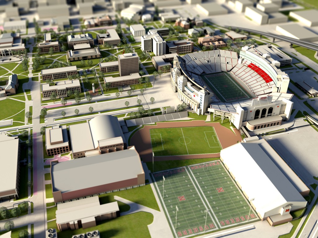
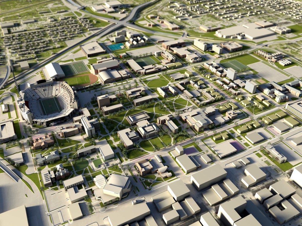
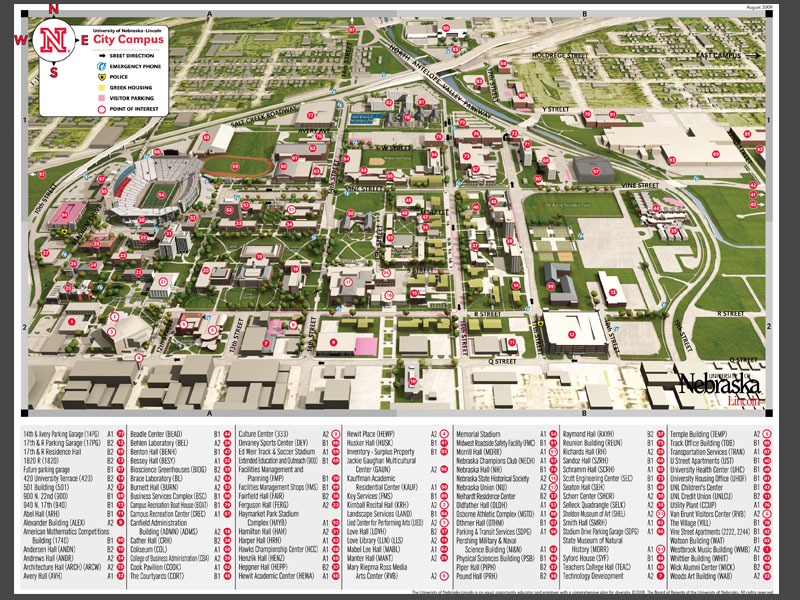
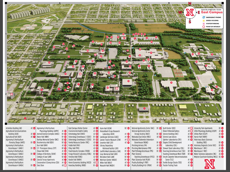
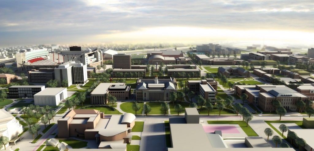
The campus maps for the University of Nebraska-Lincoln were developed as a comprehensive modeling project. As manager of the project, I, along with the help from three student workers created a detailed 3D model of every building on campus. As a comprehensive 3D model, it has many current uses and many possible future uses. But it’s main function is for printed, campus signage and online campus maps.

To create the maps, we used 3D Studio Max for the main map and Adobe Photoshop and Illustrator to add the finishing touches.

Image copyright University of Nebraska-Lincoln


Submit a comment:

Your email address will not be published. Required fields are marked *


About me


An image of Joel

Interested in knowing more about me? I'm flattered! Where do I start? Well, I am a 2004 graduate from the University of Nebraska. I've always sort of been a nerd, but my degree in computer science probably didn't help that. But I have always had a love of art, so combine the computer base with my minor in studio art and viola, you get me.

Born and raised in small town Nebraska, I'm passionate about everything this great state brings - yes even (or especially) the cold weather. Call me strange.

fresh work