3D Visualization
image from University of Oklahoma Health Sciences Center Campus Maps

University of Oklahoma Health Sciences Center Campus Maps

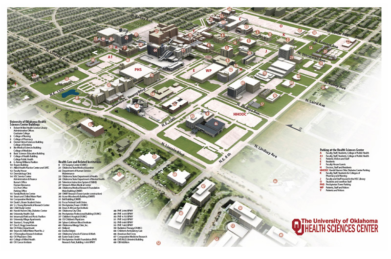
To create the campus maps for the University of Oklahoma Health Sciences Center, I created a detailed 3D model of every building on campus. After each building was created, I had a comprehensive 3D model of the entire campus that could be rendered from about any angle with any desired lighting which could showcase any portion of campus. I am not aware of how widely this model and maps are used, but the comprehensive 3D nature of the base model, the potential for uses is large.

To create the maps, I used 3D Studio Max for the main map and Adobe Photoshop and Illustrator to add the finishing touches.


Submit a comment:

Your email address will not be published. Required fields are marked *


About me


An image of Joel

Interested in knowing more about me? I'm flattered! Where do I start? Well, I am a 2004 graduate from the University of Nebraska. I've always sort of been a nerd, but my degree in computer science probably didn't help that. But I have always had a love of art, so combine the computer base with my minor in studio art and viola, you get me.

Born and raised in small town Nebraska, I'm passionate about everything this great state brings - yes even (or especially) the cold weather. Call me strange.

fresh work